To the summit of the Grand Union Canal
I have now made it to the Grand Union canal summit in Tring. From here it's all downhill to beyond Milton Keynes before the canal starts climbing again on its way to Birmingham. A summit sounds grand and it is indeed hard work with all the locks. But the summit is "only" 121m above sea level on the edge of the Chilterns. Lifting boats up to this height is no mean feat though.
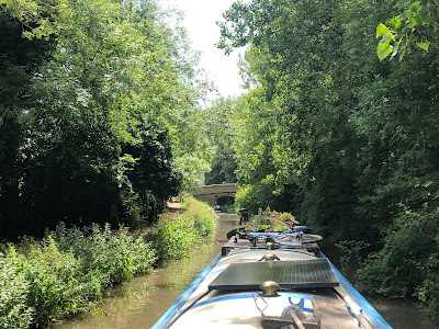
As promised I am going to focus a bit more on canal history and engineering on this cruise, but first a brief recap how I got here. I started off in Cowley in West London when the lockdown lifted. Between Cowley and Tring I went up 45 locks. Around Hemel Hempstead and Berkhamsted the locks are spaced at such distances that there is only a few minutes crusing between them. So it is a constant stopping and starting, getting on and off and waiting for locks to fill or empty. On some days I made less than 2 miles progress with all the locks. In the past I have always invited crew over to help me with this stretch and I definitely will again when all the social distancing is over. The canal is still fairly quiet these days. Leisure boaters are still
not allowed to stay overnight on their boats and the hire boat bases are
still closed. Therefore I was not able to share locks with anybody which could have speeded things up. It was fairly uneventful, pleasant and often strenuous cruising overall.
 |
| Entering Berkhamsted |
 |
| Waiting at a lock in Berkhamsted |
The only excitement (or rather panic) was a taste of water management issues near the top of the canal. Here's what happened.
I was tired after many locks and wanted to moor up for the night. It is better to moor in a longer pound (the stretch between two locks) as short pounds mean highly fluctuating water levels, when a lock is opened above or below. I was in a pound of at least 500m long, which I thought would keep the water level fairly even. When I tried to moor up I found that most of it was too shallow near the bank. Approaching the next lock I felt that this is my last chance to moor before the lock and I managed to pull the boat in to about 60cm of the bank. The boat was touching the bottom but that was not really a problem. Later in the evening I found that the water level had risen and the boat had floated close to the bank. So I pulled the ropes in a bit tighter as I didn't want to drift about too much with loose lines. Mistake!
The next morning I noticed that the boat was sitting on the bottom again and at a slight angle. But as I was having breakfast the angle started getting worse ... and worse very quickly until stuff started sliding off the table. Two problems here: it would be impossible to get the boat off the mud if it is stuck too much but worse than that if the boat lists too much the drain outlets can get to the water line and take on water. This can sink the boat! I was still quite far away from that point, but as the water went down so quickly and I had no idea how far it would go I panicked slightly. I ran to the lock just above and opened all the paddles to let water into the pound. Just at that moment two CRT (Canal and River Trust - the organisation that manages the canals) workers arrived to do exactly the same. They were running water through three locks to raise the levels. They also switched on an extra pump that pumps water from a chalk aquifer deep below to support the water level near the summit. I made a swift exit from that pound as soon as the boat was afloat again!
 |
| The pump that saved the day at Northchurch |
So that's my journey to the top done. If you are interested in the challenges of supplying a canal with water read on.
Feeding the Grand Union
When the Grand Union canal was built in the late 1700s the canal summit needed a water supply. Canal water cascades down through the locks, but rivers, springs and pumped up ground water also feed more water into it along its course. At a summit an enourmous amount of water is needed as the water runs down both sides. To get water to the summit at Tring the Wendover canal arm was built. It transported water from a spring in Wendover to Tring. The water from the spring was not enough though to keep the canal navigable at all times and the canal bed was leaking. Around the turn of the 18th century four large reservoirs were therefore built near Tring. The water from the reservoirs is pumped into the Wendover arm. In 1817 the current pumping station was built at Tringford by famous canal engineer Thomas Telford using a single steam engine to power three pumps that took the water from the reservoirs up to the canal summit level. All the infrastructure of the reservoirs and the pipes etc are still largely original, but the pumps are now three modern electric pumps.
I tried to have a look around the pumping station but sadly there is not very much to see. The water flows into the Wendover arm in an inconspicuous little inlet. The pumphouse itself is hidden behind the hedge next to the towpath. On the road it is possible to walk up to the pumphouse but it's not possible to see the actual pumps. Apparently there are open days every now and then. The only evidence of the infrastructure underground where some valves and shafts (I assume) nearby. Interestingly the actual summit level is quite a bit higher than the reservoirs.
 |
| The unspectular inlet of water from the reservoirs - pumping station behind |
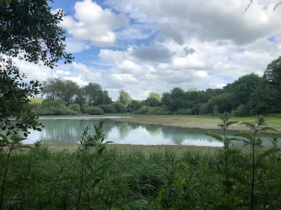
The reservoirs (and the adjacent Marsworth lock flight) are a popular beauty spot as they are set in very beautiful surroundings and are some of the best bird watching sites in Southern England. I am no bird expert, but I enjoyed watching them too. They are not just the usual ducks, swans, geese and coots. I even saw a kingfisher diving just in front of my boat as I was cruising along. The level of the reservoirs was about a metre below maximum. I don't know if this is normal, but there hasn't been a lot of rain in spring. I hope that there'll be enough water to fully support navigation throughout the summer.
 |
| One of the reservoirs with quite low water level |
 |
| Embankment around the reservoir |
 |
| Panorama view - click to enlarge |
The Wendover Arm
It is worth looking at the Wendover arm itself a bit more. Built as a feeder channel originally it was made navigable soon after completion in 1799 at little extra cost. The canal supported the gas works (now gone) and the flour mill (still working today) located alongside. The canal winds through the wheat fields that supply the flour mill even today. Another import by boat into this area was horse manure from London to fertilise the fields. The canal runs over land owned by the Rothschild family. They have a fancy bridge to remind everybody of that.
 |
| Bridge with Rothschild coat of arms |
The canal had problems with leakage though from the start. As it got worse and worse over the years a stop lock was even built to prevent it draining the Grand Union! The canal was finally abandoned toward the end of the 19th century. The spring in Wendover that was the original motivation to build this canal now runs off underground feeding into the reservoirs.
 |
| Disused stop lock |
The Wendover arm has been made navigable again to about 1.5 miles in from the junction with the Grand Union. The work has been done solely through donations to the Wendover Arm Trust and volunteer work. It is one of the most idyllic canals I have been on, winding through open fields with great views of the Chilterns and the reservoirs. At the end there are 48h moorings for about 10 boats. It is a very peaceful place.
 |
| View of a reservoir from Wendover arm |
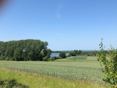
Continuing on to Wendover along the unrestored section the towpath has been well maintained all the way and work is ongoing to prepare more sections to open again. I cycled all the way to the end about 6 miles to Wendover. After the restored part the canal bed is initially dry, but a bit further on it is full of water from the original spring in Wendover. It looks like it would not actually take that much to open this canal again as everything seems to be quite well preserved although according to a resident the leakage is still a problem. The whole length is beautiful, winding through fields and also a lovely wooded section.
 |
| Dry section of Wendover arm |
 |
| Restoration work on Wendover arm |
 |
| Disused inlets |
 |
| Section fed by the spring |
 |
| Wooded section |
At the end near the centre of Wendover it just ends unceremoniously at a tiny
waterfall where the natural spring comes in. There is no canal basin or
turning point (winding hole) for boats here. I assume that they probably
used to turn in the wide bit shortly before and not navigate to the
actual end of the canal.
 |
| The spring feeding the Wendover arm and the reservoirs |


Comments
Post a Comment